Happy Canada Day!

Happy Canada Day from the iHunter team


Designed and built in Canada

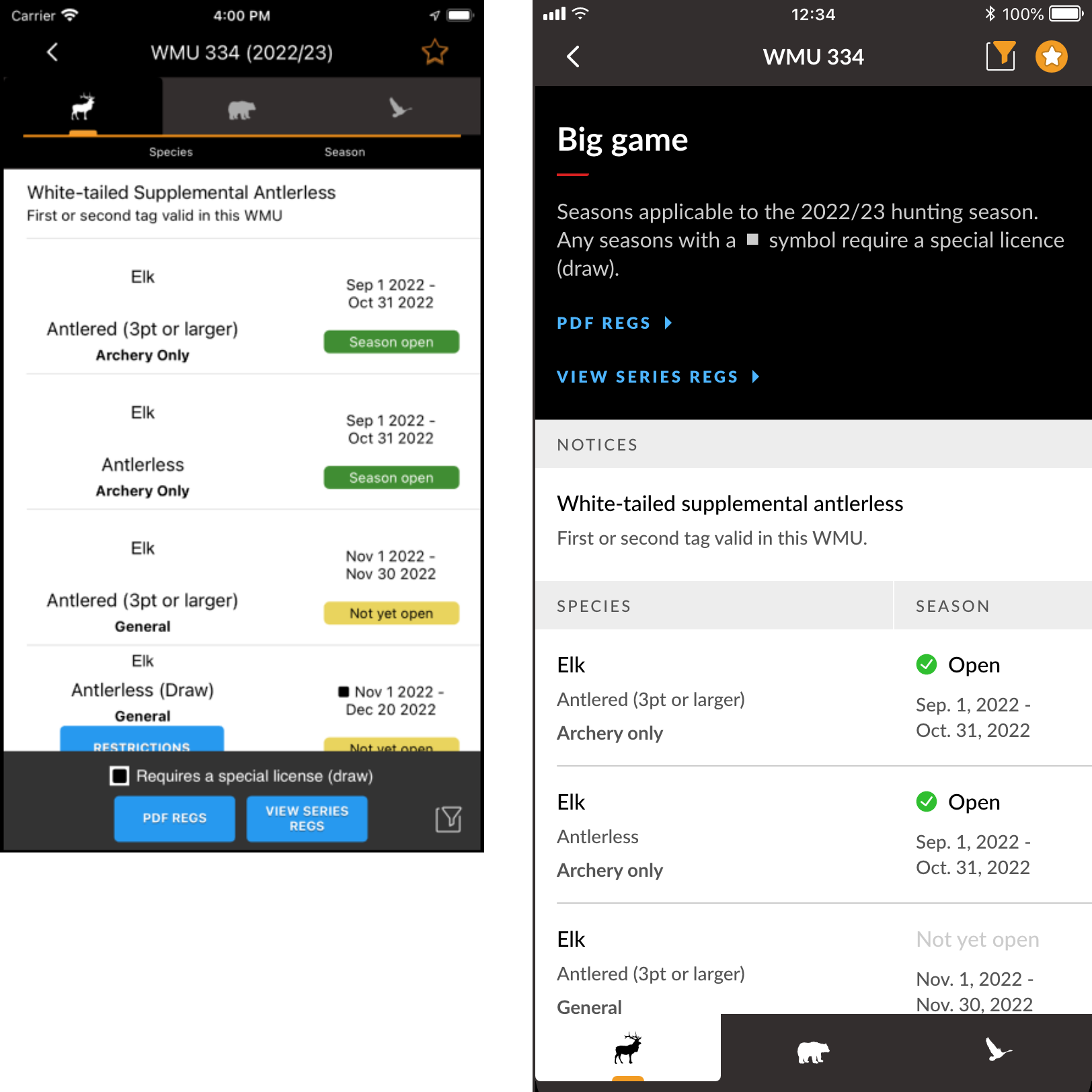
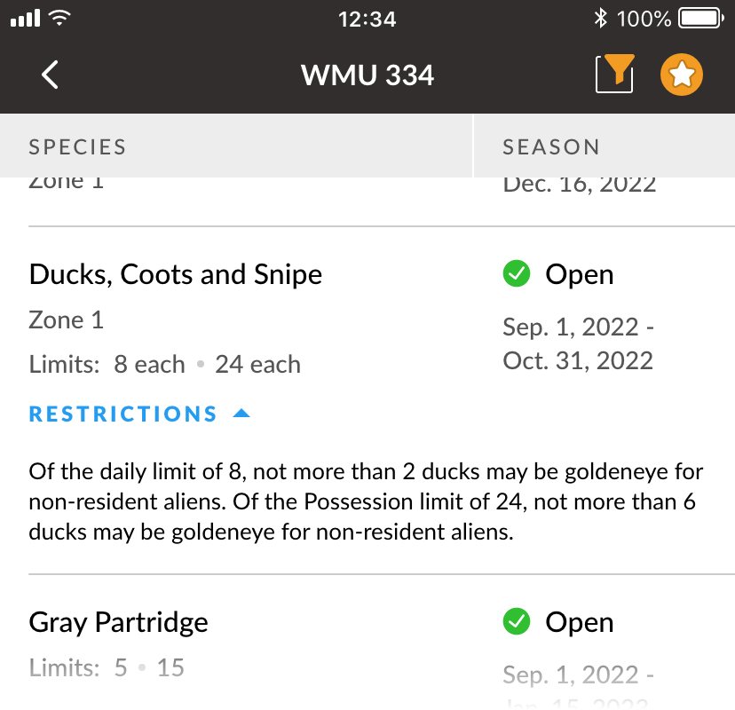
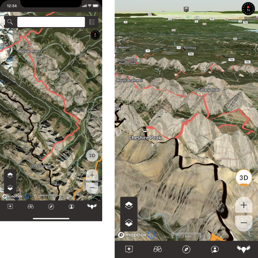
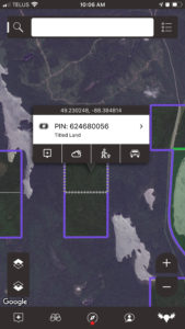
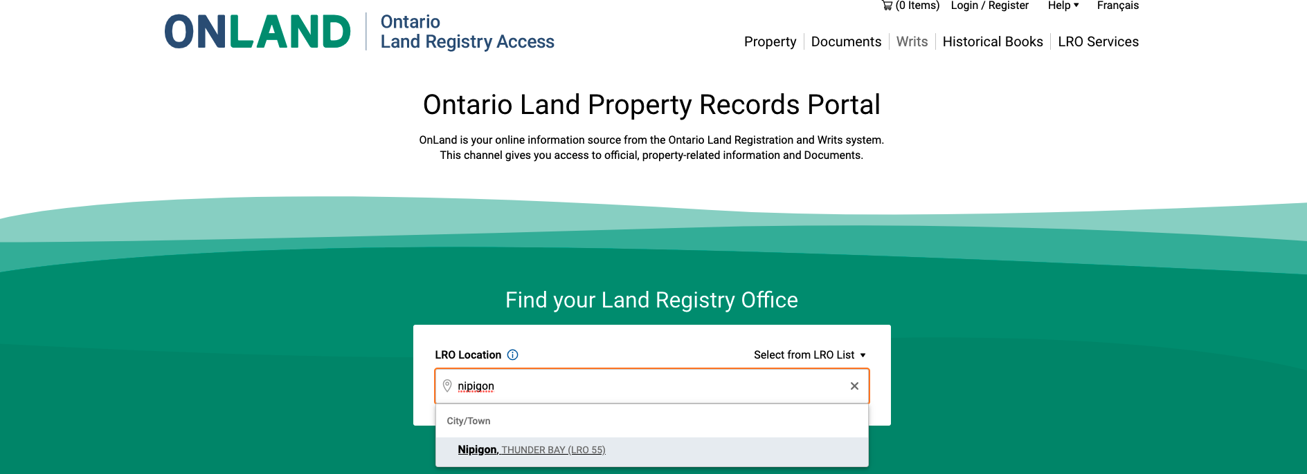
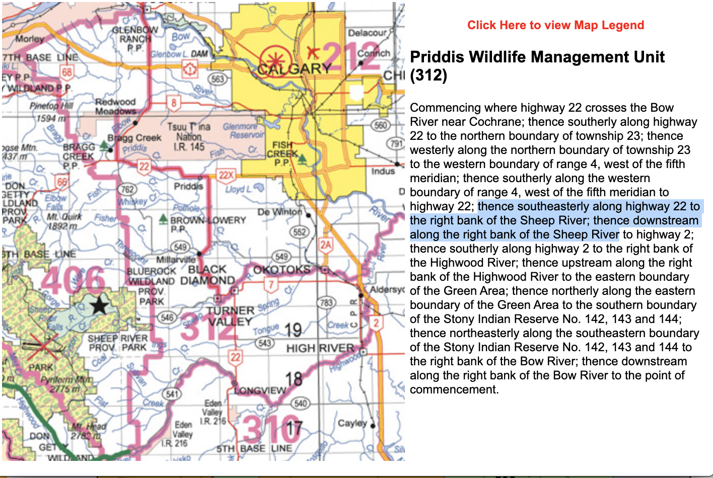
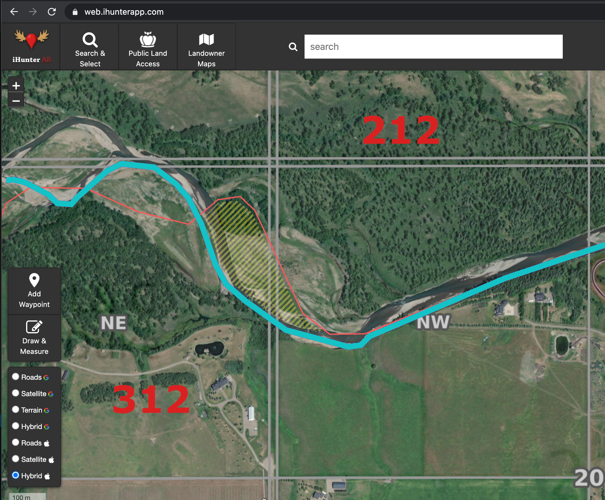
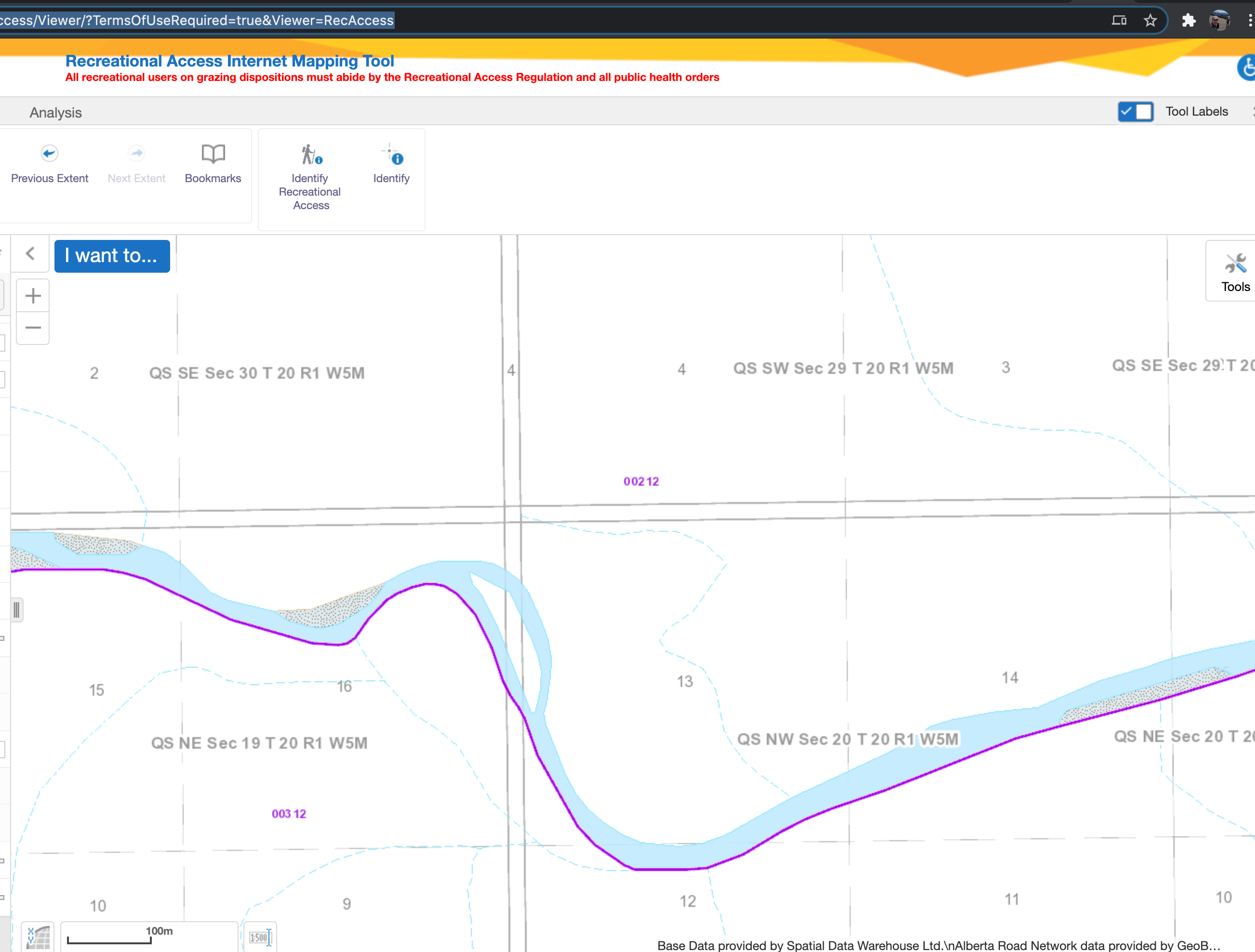
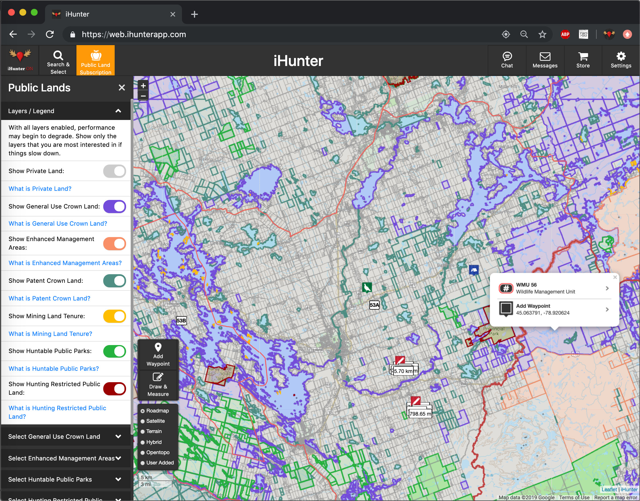
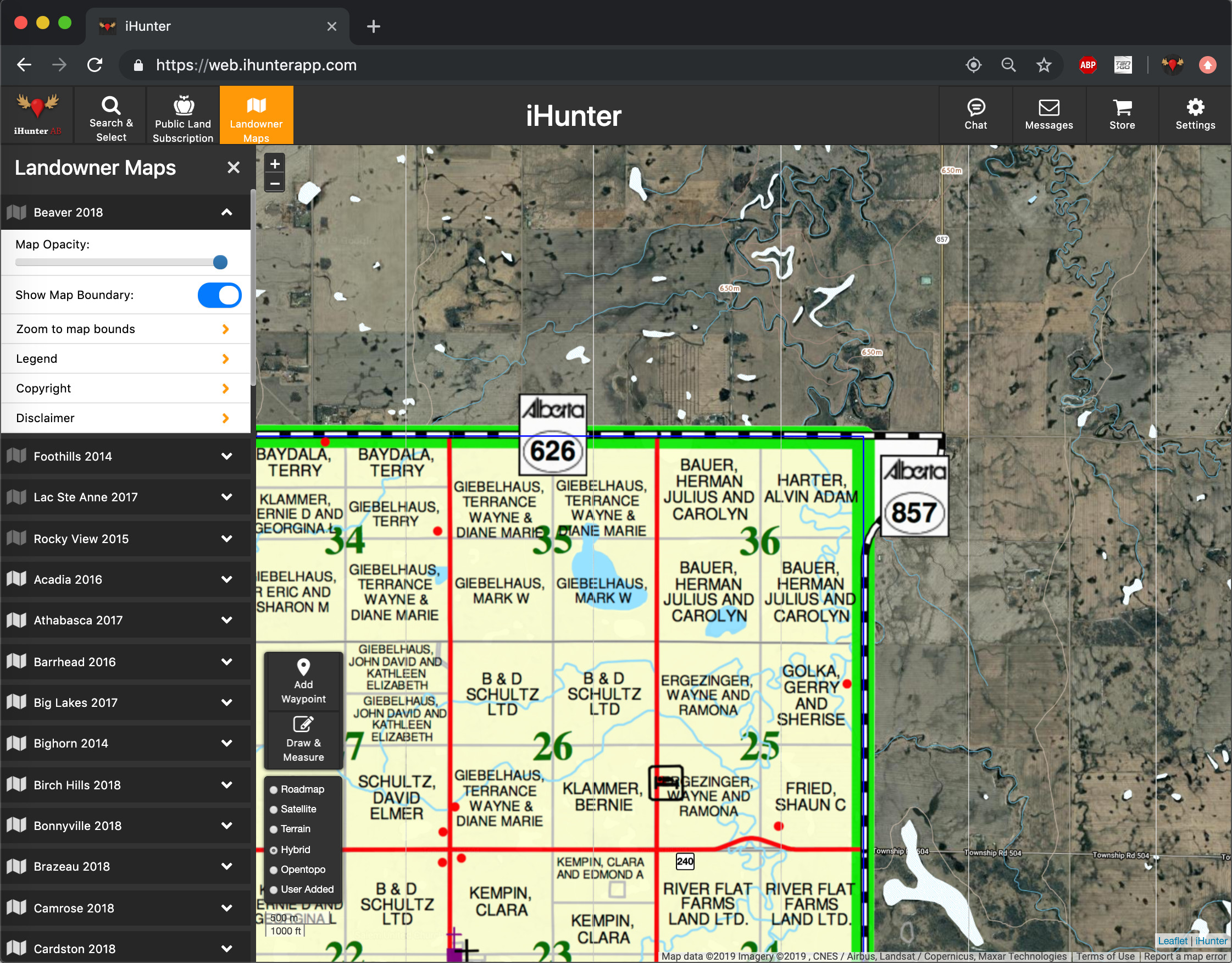
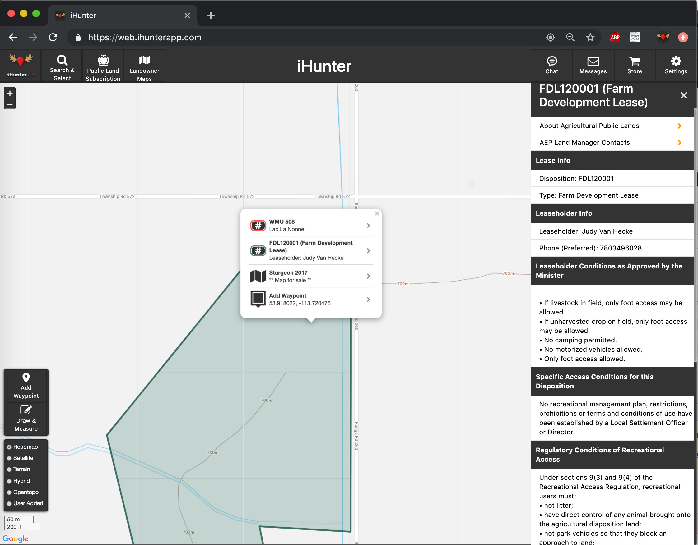
iHunter stands out as the premier hunting app in Canada, proudly holding the distinction of being the country’s sole Canadian hunting app. This app is tailored specifically to the needs of Canadian hunters, providing a comprehensive and reliable resource for outdoor enthusiasts across the nation. With iHunter, users gain access to a wealth of local information on hunting regulations, season summaries, and licensing requirements that are specific to Canada’s diverse provinces and territories. The app offers detailed maps, GPS functionality, and advanced tracking features, empowering hunters to navigate their surroundings with confidence and efficiency. By supporting iHunter, Canadian hunters support a homegrown solution that caters to their unique needs while contributing to the growth and success of the hunting community in Canada.

The iHunter team is composed of five Canadians spanning the country from Alberta to Nova Scotia. They work tirelessly to develop and maintain the app, ensuring its functionality, accuracy, and continuous improvement. By choosing iHunter, you are supporting these dedicated individuals and their families, allowing them to pursue their passion for technology and hunting while helping stimulate innovation and entrepreneurship within Canada.


iHunter Store

This Canada Day iHunter is launching its own online store at store.ihunterapp.com. To celebrate this milestone, iHunter is hosting a special Canada Day sale, offering a 20% discount on subscriptions and landowner maps. Now is the perfect time to take advantage of this limited-time offer and unlock the full potential of iHunter’s premium features.

Additionally, the iHunter Store will be a go-to destination for users to conveniently access and receive 20% off on landowner map updates whenever a new version is released. By launching the iHunter Store and providing these exclusive discounts, iHunter continues to demonstrate its commitment to enhancing the hunting experience for Canadian users while celebrating the spirit of Canada Day. Don’t miss out on these fantastic deals and gear up for unforgettable hunting adventures with iHunter!

National Backup Day

As outdoor enthusiasts, we rely heavily on our electronic devices to navigate the wilderness. Whether it’s using our smartphones, tablets or GPS devices, we often record our tracks, waypoints, and drawings to ensure we can easily find our way back. However, these devices are not invincible, and data loss can occur due to various reasons such as software glitches, hardware malfunctions, or accidental deletions. To prevent the loss of our valuable data, we need to ensure we have a backup of our data.

March 31st is National Backup Day, and it’s an excellent reminder to back up your data. If you are an iHunter user, it’s essential to log into an iHunter account to ensure your data is backed up securely. By backing up your data, you can easily restore it in case of data loss due to device malfunction, accidental deletion, or switching to a new phone.

Backing up your data on iHunter is easy. If you are logged into an iHunter account then it’s already done! If not, here are the steps to follow:

  • Tap on the bottom right iHunter button, you will see the option to log in.
  • Tap “Log in” to create an iHunter Account and your waypoints, tracks, and drawings will automatically be backed up.

Alternatively, you can back up your data manually by exporting it and storing it in a secure location. To do so:

  • Tap on the bottom right iHunter button
  • Tap on “App settings”
  • Tap on “Export waypoints”
  • Tap the green checkmark on the top right
  • Email the file to yourself to retain a backup

By backing up your data on iHunter, you can rest assured that your valuable data is safe and secure. It’s an excellent way to celebrate National Backup Day and ensure you don’t lose your data due to unexpected circumstances. So, log in to your iHunter account today and backup your data.

Wild TV app

If you’re a fan of iHunter then chances are you love hunting and all things outdoors. You want access to great content and experiences even when you can’t be in the great Canadian wilderness yourself. To help make that happen we’ve teamed up with Wild TV to get the word out about their new app so you can watch all of your favourite hunting content where you want and when you want.

Wild TV app screenshots

Download the Wild TV app and sign up for the free trial subscription to gain access to all their hunting and fishing TV shows. To sweeten the deal we’re running a promo code on iHunter WEB that will let you save on landowner maps and the first year of a new Public Lands subscription. You can find more information and links to all of the products you need at link below:

iHunter and Wild TV apps

Check it out

Happy hunting!

Season summaries view

The latest iHunter release includes an update look and feel for the season summaries screen. All of the same regulation content is still there but we’ve moved some things around to make that content even easier to use. The species types are now down at your fingertips so you can quickly find the big game, predator, game bird or small game that you’re looking for. Regulations docs, filters, and making the zone one of your favourites are now at the top.

Hunting zone season summary comparison.


Seasons with additional restrictions now open right in place so you always know exactly what you’re looking at. Show them or hide them, it’s up to you and won’t get in your way.

Hunting zone season restrictions.


We’re excited to finally get the season summary update into your hands now as we continue to update and enhance iHunter. Make sure to always know the rules for where you are to stay safe and stay legal. Happy hunting.

3D base maps (and what beta means)

The iHunter team is always working hard on something new to make it the best tool it can be. In our continuing effort to get new stuff into your hands quickly, this season we’re launching our first beta feature: Mapbox base maps with 3D.

You’ll notice it’s labelled as “beta” in the base map list. This means we haven’t quite put all of the finishing touches on it, but because we don’t want to keep you waiting, it’s ready for you to try now. Just download the latest update from the App Store.


Beta features

Beta features are something you’ll see more often going forward. Some of them will eventually end up as part of the iHunter annual subscription, some of them will just become basic features of the app. Either way, the plan is to get powerful new features into your hands first, and for an entire hunting season. That way everyone gets a chance to use them and help us make iHunter even better.


Known issues

As we mentioned, there are still a couple of things being finished. See the list below for what to expect and make sure you aren’t impacted in the field.

Android

  • (Mapbox) Satellite and Hybrid base map imagery cannot currently be cached for offline use.
  • (Mapbox) 3D elevation data cannot currently be cached for offline use.
  • (Mapbox) Cannot recolour Remote layers. This affects mainly private/titled land layers.
  • (Mapbox) Gestures at high zoom levels while in 3D can cause undesired zoom behaviour.
  • (Mapbox) Compass mode needs improvement.

iOS

  • (Mapbox) 3D elevation data cannot currently be cached for offline use.
  • (Mapbox) Cannot recolour Remote layers. This affects mainly private/titled land layers.
  • (Mapbox) Gestures at high zoom levels while in 3D can cause undesired zoom behaviour.

Use iHunter Ontario to easily find property information

As part of the iHunter Ontario Public lands subscription you’ll gain access to the Titled Land layer. This layer gives you the ability to view private/titled land on the map, with property boundaries shown with a grey line. One of the benefits of using the Titled Land layer the ability to look up any property’s PIN (Parcel Identification Number). If you tap inside a boundary you’ll notice the pop-up window which includes the PIN for that specific piece of private/titled land.

iHunter

Now that you have a PIN, you find yourself wanting more information about the property. The first thing you’ll want to do is navigate to the the OnLand Website here: https://www.onland.ca/ui/ . The next step is going to be to input your LRO (Land Registry Office) Location. You can simply type in the city or town where the land you’re looking for is. You should see an option for the town or city with an LRO number next to it, choose the LRO and you should see some land registry services populate below.OnLand

Here you can find services for property information, legal documents and resources related to land ownership and geographic information, historical records for registered property information and even request document submission, corrections and overrides. To find property information click the search button on the Property option on the left hand side.OnLand

This is where you can find property information by using the PIN (Parcel Identification Number), Address, Registration Number, or even by searching for the property via the Map option. Since we already have the PIN by using the Public Lands subscription in iHunter, we can simply input the PIN and get more information on the property. OnLand


At this point, the parcel description itself may contain enough information for you. It should contain the lot and concession numbers, and could also indicate whether the lot is a road allowance (RDAL abbreviation), etc. If not, you can use the Buy Parcel Register to find out the detailed information such as owner name and registered mailing address.

We hope this article was useful and helped you find the property information your looking for, if you have any questions or concerns please feel free to reach out to us at info@ihunterapp.com

Hunter Samples are Vital to CWD Prevention and Response (BC)

A guest post by Cait Nelson, BC CWD Program Lead

Although Chronic Wasting Disease (CWD) has not yet been detected in B.C., the risk of the disease affecting B.C. wildlife populations is increasing every day. CWD is on our doorstep with cases detected within 50 kms from the B.C. border in both Montana and Alberta. The B.C. Wildlife Health Program, along with their team of partners and supporters, are working hard to keep CWD out of B.C. but it will require a team effort.

Anyone that cares about healthy and sustainable deer, elk, moose, and caribou populations has a responsibility to understand the CWD situation, the risks, and the role that they can play in prevention. No one understands this better than hunters. The B.C. CWD Program would not be possible without the support of (and samples from) the hunting community in this province. Hunters have contributed over 80% of the total number of samples submitted for CWD testing. These contributions are providing vital information that will be necessary for a rapid and effective response to a CWD detection in B.C. More testing will ensure that the disease is detected as soon as possible before it has a chance to spread and infect more animals. Testing also provides information about the health status of adjacent populations, which ultimately will allow response management to be conducted over a smaller geographic area.

As we have learned from other places affected by CWD, the management of this disease has been very challenging and costly. Once CWD is established in a free ranging cervid population it is impossible to eradicate. Prevention is the best strategy – but if that is not possible, detecting it early and having information to make smart decisions will give B.C. the best chance of limiting the negative impacts of CWD. Hunter support and participation in response efforts will be essential. For now, this is an extremely critical time for us to stand together in the fight against CWD.

B.C. Wildlife Health is asking hunters to submit deer, elk, moose, and caribou heads for CWD testing from anywhere in the Province. This is voluntary is most areas and mandatory for deer in parts of the Kootenay Region (see the hunting regulations for the updated Management Units). Every sample counts and will help us to stay ahead of this disease.

For more information contact BC Wildlife Health at 250-751-3219 or visit the website: www.gov.bc.ca/chronicwastingdisease

A Renewed Focus on Canada

iHunter has been working on improving access to hunting related information for the past 9 years. We started local in Alberta, and have expanded across Canada and into the US a state/province at a time. Our Canadian products have garnered a really strong base of support that is growing every year, but that same support is just not coming around for the 6 states that we have integrated.

The reasons for limited uptake in the US are many and complex, but ultimately it comes down to our lack of willingness (or lack of ability) to throw big marketing budgets at the US market. It costs some very real dollars to gain market share that is currently dominated by some big American players. Although there is a large potential upside in the US market, we have decided to remove support for the American markets we currently have integrated into iHunter, and dedicate our efforts to the Canadian market. The parts of iHunter specific to MT, OR, CO, WA, ID and PA will be removed from sale sometime in the next couple of weeks. If you have already made a purchase of these regions, you can continue using them as is for now (no updates coming to these regions for the upcoming seasons). Eventually, these regions will be removed entirely.

Canada is often underserved when it comes to cutting edge products with local content. We have been working to change that in the hunting industry for many years, and feel like we have done a pretty great job so far, with some gaps. In most regions, we have been able to offer the base version of iHunter with hunting zone boundaries, seasons summaries, GPS based tools and other features made especially for hunters. In many of those, we have also made available subscriptions or in-app purchases that show land ownership, identify public lands, and document restrictions on access or hunting limitations. Our intention is to continue expanding these advanced components in areas we already have them, and building new Public Lands subscriptions in others. This year we have added a Public Lands subscription for Manitoba and Nova Scotia, while improving existing offerings in BC, Alberta, Saskatchewan, Ontario and New Brunswick.

Thanks to the users that have been supporting us for the past 9 years, and hope we can continue meeting your expectations in the years to come.

-Mark

Legal vs Visual Hunting Boundaries

The use of iHunter and other digital mapping apps has skyrocketed over the past 10 or so years. They expose a wealth of openly available data to hunters and simplify so many aspects of scouting and hunting. However, as hunters rely more heavily on the data that is displayed, fewer and fewer read the legal descriptions of the zones depicted. They don’t know that the legal boundary is not a fixed series of lat/lon coordinates, but may actually be defined in relation to a dynamic and ever changing physical feature.

With GIS data being openly provided by various levels of Government, individuals and private companies are able to innovate and deliver compelling solutions to end users. However, the data available is always just a snapshot in time, and when the boundaries of interest follow the southern bank of a winding river (or something similar), those boundaries could be inaccurate representation just months after they were published.  Although we would like to think that these data sets could be keep them up to date, it is not always the case. And as iHunter currently does not modify provincially provided data sets, the boundaries shown could have discrepancies from the legal descriptions. As such, you should always read and know the legal boundary for a hunting zone, especially if you are hunting near a boundary.

An Example Scenario – WMU 212/312 – Alberta

We were recently made aware of a boundary discrepancy between WMU 212 (Calgary Bow Zone) and WMU 312 (Rifle and Bow Permitted). The boundary is described as follows:

As mentioned above, boundaries defined by natural features can change as time goes on. In this case, the Sheep River was affected by the 2013 flood, and the landscape has drastically changed. The boundary has changed, but the digital boundary has not been updated. The Digital boundary as shown in iHunter is the thin Red line. The new approximate boundary, based at least on satellite imagery is the blue line. As you can see, the shaded are is shown as WMU 312, but by law has become part of WMU 212.

Not a big deal you say? No one would try to hunt that close to a boundary based on GPS anyway? Think again. With the use of seemingly precise instruments such as GPS (6-10 m accuracy) and satellite imagery (similar 6-10 m accuracy), many hunters are indeed making use of every bit of accessible land. However, when the digital data can’t or doesn’t align with the natural feature that defines it, the hunter may be committing an offence, subject to seizure of the animal and a variety of charges. In this case, a person might be hunting with a firearm in the archery only WMU 212, while thinking they were in WMU 312. The penalties for such an offence can be substantial.

The Province’s Rec Access website tool displays the same data, as shown in the image below. Their river layer is also based on the former path, so at least you can see why the data is as it is. Pretty much all mapping tools out there are going to be using the same set of data, so no matter where a hunter looks, they are getting inaccurate information. Only by reading the Legal Description can they be certain the are hunting legally.

The Province of Alberta’s GIS team is now investigating and hopefully we can get these digital boundaries updated to match the current landscape. That could take longer than one would like, though, so it’s a good idea to read and understand the Legal Boundary description. In Alberta, those can be found at https://albertaregulations.ca/huntingregs/season-wmus.html


Conclusion

The iHunter team, and all the GIS folks at various levels of government work really hard to publish accurate boundary data to help hunters make sense of the legislation that governs hunting. The convenient display of that data does not relieve the hunter of their responsibility to know and understand all rules and regulations pertaining to their hunt. This means knowing the legal boundaries that are relevant, knowing they have permission to be hunting where they are, and knowing the above by consulting the appropriate legal source.  We will continue to our best with the data and tools we have access to, and as hunters we all need to do our best to stay on the right side of all rules and regulations in the field.

-Mark

iHunter Web App – web.ihunterapp.com

If you follow us on social media (Instagram: @ihunterapp, Facebook: iHunter Apps), then you may already know that we recently launched our first web version of iHunter. We have had many requests over the years for a version of iHunter to use on regular laptops and desktops to allow the user to view the same boundary, regulation and land ownership information to help with at-home scouting (eScouting).

An incredible amount of effort went into this, and although there are still some rough edges, we think we came up with a pretty usable and stable tool. By logging into your mobile app, and using that same login on https://web.ihunterapp.com, all your waypoint data, maps and settings will be synchronized.

We provide access to all the “base” features of iHunter (hunting zone boundaries, season summaries, waypoints, chat, etc) free of charge. Even pieces of the Pro Tools are included such as Drawing & Measuring and the ability to add new map layers from external sources. Once you see the value it provides on the web, we feel confident you will purchase the same functionality on mobile.

Now, as this is a new project, we need you help to identify bugs and performance issues. If you see something not working, or unsure about how something should be working, let us know. Use the “Email Us” button in the main iHunter menu (top left corner) to send us diagnostic info that will help us narrow down the issue.

-Mark