iHunter Newfoundland Pro Subscription
The iHunter Newfoundland and Labrador Pro subscription adds 8 additional map layers including: Private Conservation Lands, Firearm Setbacks, Huntable Public Areas, Municipalities, Hinting Restricted Areas, Private Land, Regional Pastures, and the Road and Ferry Network.
To use these layers on your map, first make sure you have iHunter NL:


Then either try it free for 7 days or subscribe for only $14.99 per year to benefit from the layers being updated annually.
map layer
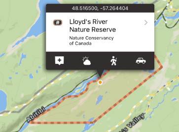
Private Conservation Lands
Many parcels of private land are owned by Conservation organizations such as Nature Conservancy of Canada. This layer maps and lists these properties with instructions on how to contact them for inquiries. Public access varies from organization to organization, and the user is responsible for determining access by contacting the conservation organization.
These boundaries are shown in pale orange on the map, and are built into the app as part of the subscription. They can be used even without cell coverage.
map layer
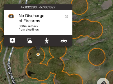
Firearm Setbacks
Hunting, and discharge of hunting weapons, is restricted in a variety of locations. It is unlawful to discharge a firearm (including bows or crossbows) within 1000 meters of a school, playground or athletic field or within 300 meters of a dwelling. These setbacks have been mapped based on a buildings dataset produced from satellite imagery. This dataset is an attempt to map out buildings across the province, however it is not a complete depiction of every building in the province. This dataset does not include playgrounds and athletic fields and does not distinguish between dwellings and buildings.
These areas are shown in a orange border with a semi-transparent fill. Each time a new area of the map is viewed, or a new zoom level is looked at, that portion of the layer needs to be downloaded (requiring cell or Wifi service). Once downloaded, those tiles are cached on device for future offline use. You can also pre-cache regions of this layer by using the Manage Cache button.
map layer
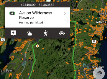
Huntable Public Areas
This layer includes the boundaries for huntable waterway provincial parks and ecological reserves. Specific rules for both access and hunting may exist.
These boundaries are shown in green on the map, and are built into the app as part of the subscription. They can be used even without cell coverage. Tapping on the area will give additional information about the selected land.
map layer
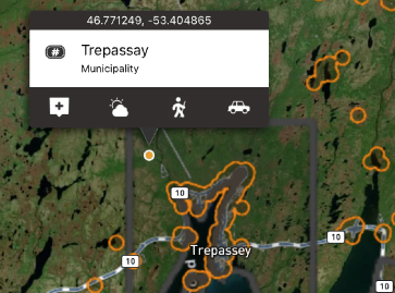
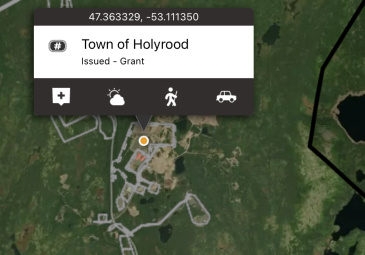
Municipalities
Municipalities have the authority to enforce shooting and hunting restrictions within their jurisdictions. By having these boundaries mapped, you can assess whether you are within the municipal boundary and subject to its bylaws.
They are shown in dark grey on the map, and are built into the app as part of the subscription. They can be used even without cell coverage. Tapping on the area will give municipality name and type.
map layer
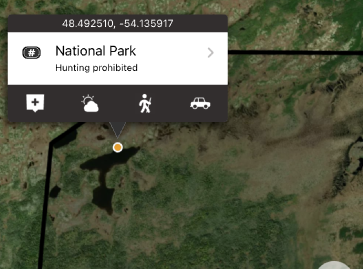
Hunting Restricted Areas
Some land designations forbid hunting by definition. Those area designations included in this layer include some Provincial Parks, Ecological Reserves, National Parks, Wildlife Refuges, Migratory Bird Sanctuaries, Seabird Ecological Reserves. This is not a complete listing of every parcel of land the dis-allows hunting. It is merely a visualization of the defined hunting restricted areas as listed above. Hunting restricted areas (Closed Areas) described in the Hunting and Trapping Guide which do not have digital boundaries published by the province have been included, however they should be used as a guide only as they may contain inaccuracies.
They are shown in black on the map, and are built into the app as part of the subscription. They can be used even without cell coverage.
map layer
Private Land
In Newfoundland and Labrador, the distinction between public and private land for hunting is governed by the Lands Act and the Wild Life Act. The layer contains crown grants, crown leases, and other classifications of land deemed private.
These areas are shown in a grey border with a semi-transparent grey fill. Each time a new area of the map is viewed, or a new zoom level is looked at, that portion of the layer needs to be downloaded (requiring cell or Wifi service). Once downloaded, those tiles are cached on device for future offline use. You can pre-cache regions of this layer by using the Manage Cache button (Add Region to Cache).
map layer
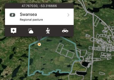
Regional Pastures
This layer shows the boundaries of the Regional Pastures. It is unlawful to discharge a firearm or hunt on most community pastures during the period May 1 to November 30 inclusive.
For For more information, see https://www.assembly.nl.ca/legislation/sr/regulations/rc980056.htm or contact your nearest Department of Ferestry, Agriculture, and Lands office.
They are shown in teal on the map, and are built into the app. They can be used even without cell coverage.
map layer
Road and Ferry Network
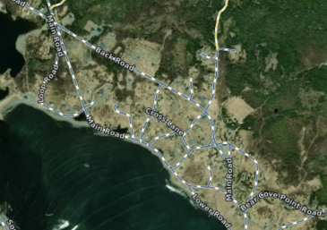
This layer contains a combination of primary, secondary, and resource roads. It also includes ferry routes in Newfoundland and Labrador. The different road and ferry types are represented with different colours.
The roads are shown as dashed lines on the map and coloured to indicate their status:
Blue indicates primary and secondary roads.
Green indicates resource roads.
Yellow indicates closed, limited, unknown, or atv-only Resource roads.
The ferry routes are shown as solid Blue lines
Each time a new area of the map is viewed, or a new zoom level is looked at, that portion of the layer needs to be downloaded (requiring cell or Wifi service). Once downloaded, those tiles are cached on device for future offline use. You can pre-cache regions of this layer by using the Manage Cache button (Add Region to Cache).