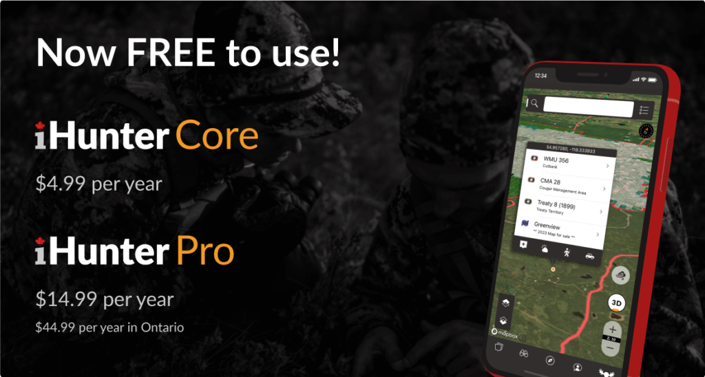
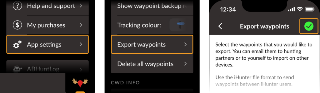
The use of iHunter and other digital mapping apps has skyrocketed over the past 10 or so years. They expose a wealth of openly available data to hunters and simplify so many aspects of scouting and hunting. However, as hunters rely more heavily on the data that is displayed, fewer and fewer read the legal descriptions of the zones depicted. They don’t know that the legal boundary is not a fixed series of lat/lon coordinates, but may actually be defined in relation to a dynamic and ever changing physical feature.
With GIS data being openly provided by various levels of Government, individuals and private companies are able to innovate and deliver compelling solutions to end users. However, the data available is always just a snapshot in time, and when the boundaries of interest follow the southern bank of a winding river (or something similar), those boundaries could be inaccurate representation just months after they were published. Although we would like to think that these data sets could be keep them up to date, it is not always the case. And as iHunter currently does not modify provincially provided data sets, the boundaries shown could have discrepancies from the legal descriptions. As such, you should always read and know the legal boundary for a hunting zone, especially if you are hunting near a boundary.
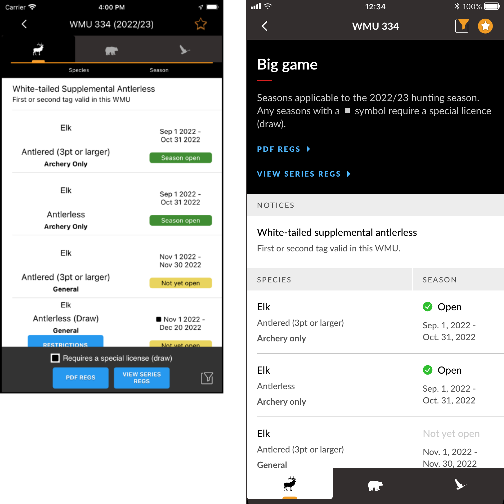
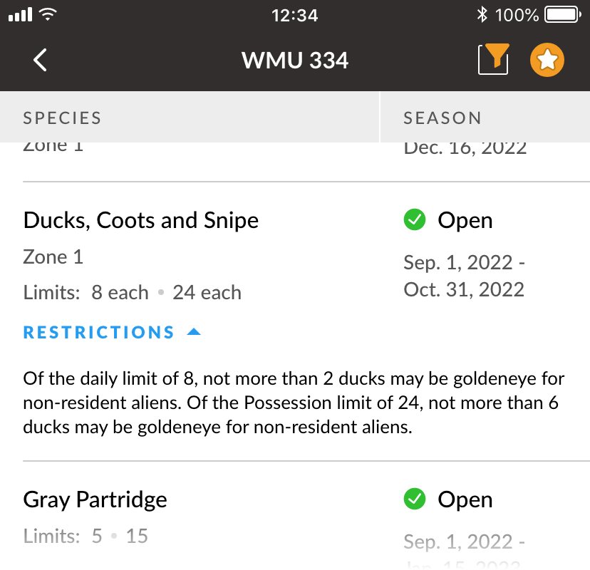
An Example Scenario – WMU 212/312 – Alberta
We were recently made aware of a boundary discrepancy between WMU 212 (Calgary Bow Zone) and WMU 312 (Rifle and Bow Permitted). The boundary is described as follows:
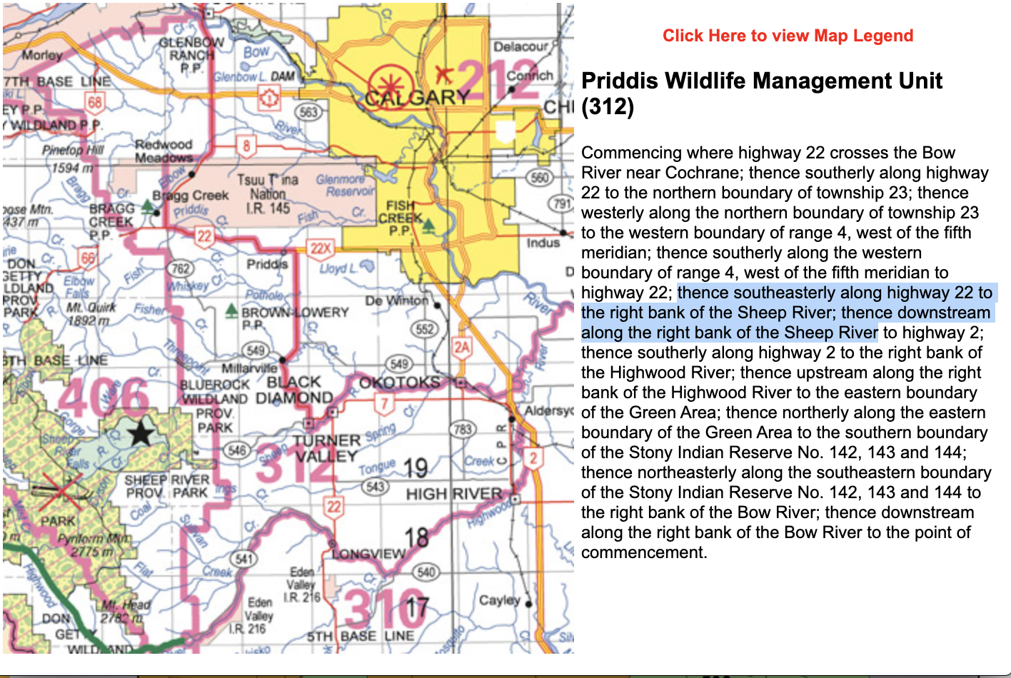
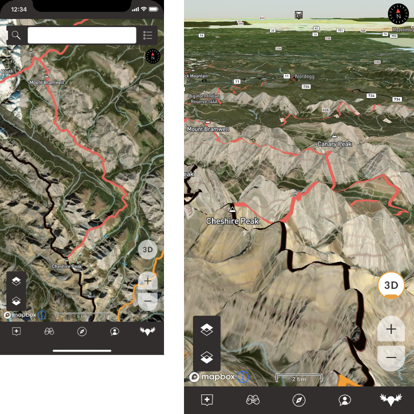
As mentioned above, boundaries defined by natural features can change as time goes on. In this case, the Sheep River was affected by the 2013 flood, and the landscape has drastically changed. The boundary has changed, but the digital boundary has not been updated. The Digital boundary as shown in iHunter is the thin Red line. The new approximate boundary, based at least on satellite imagery is the blue line. As you can see, the shaded are is shown as WMU 312, but by law has become part of WMU 212.
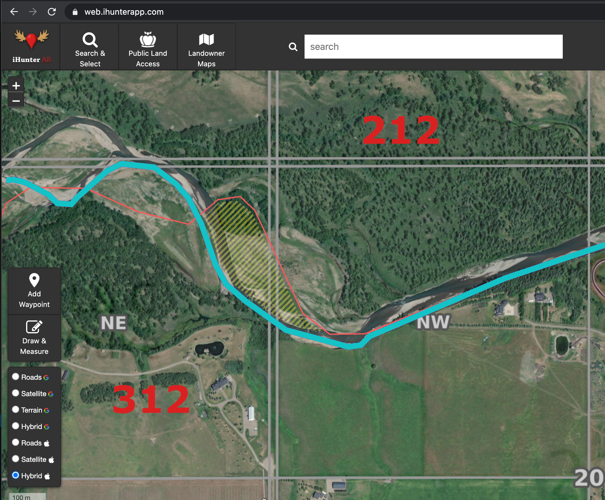
Not a big deal you say? No one would try to hunt that close to a boundary based on GPS anyway? Think again. With the use of seemingly precise instruments such as GPS (6-10 m accuracy) and satellite imagery (similar 6-10 m accuracy), many hunters are indeed making use of every bit of accessible land. However, when the digital data can’t or doesn’t align with the natural feature that defines it, the hunter may be committing an offence, subject to seizure of the animal and a variety of charges. In this case, a person might be hunting with a firearm in the archery only WMU 212, while thinking they were in WMU 312. The penalties for such an offence can be substantial.
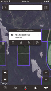
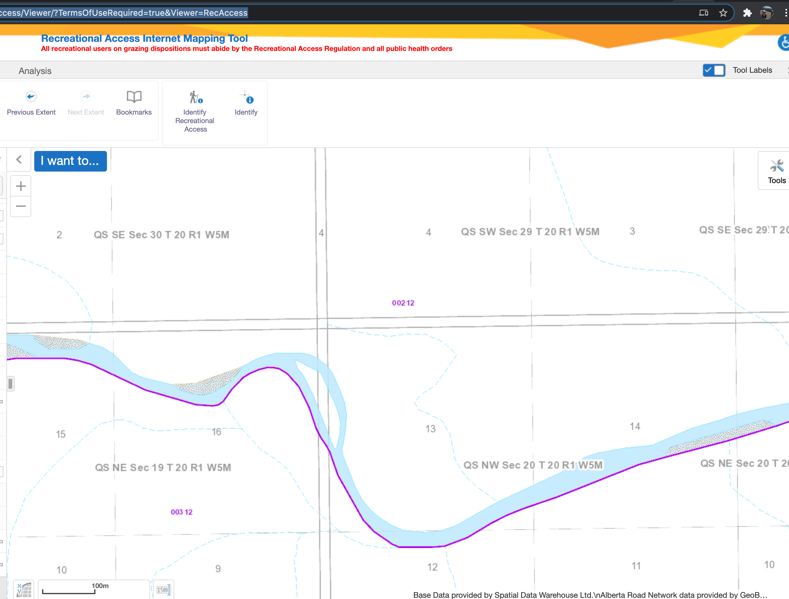
The Province’s Rec Access website tool displays the same data, as shown in the image below. Their river layer is also based on the former path, so at least you can see why the data is as it is. Pretty much all mapping tools out there are going to be using the same set of data, so no matter where a hunter looks, they are getting inaccurate information. Only by reading the Legal Description can they be certain the are hunting legally.
The Province of Alberta’s GIS team is now investigating and hopefully we can get these digital boundaries updated to match the current landscape. That could take longer than one would like, though, so it’s a good idea to read and understand the Legal Boundary description. In Alberta, those can be found at https://albertaregulations.ca/huntingregs/season-wmus.html
Conclusion
The iHunter team, and all the GIS folks at various levels of government work really hard to publish accurate boundary data to help hunters make sense of the legislation that governs hunting. The convenient display of that data does not relieve the hunter of their responsibility to know and understand all rules and regulations pertaining to their hunt. This means knowing the legal boundaries that are relevant, knowing they have permission to be hunting where they are, and knowing the above by consulting the appropriate legal source. We will continue to our best with the data and tools we have access to, and as hunters we all need to do our best to stay on the right side of all rules and regulations in the field.
-Mark