New versions of the apps

If you are one of those iPhone or Android users that looks at every app update coming onto their phone, and pays attention to when and how ofter apps update, you will have noticed an increase in the number of iHunter releases lately.

On both iOS and Android, as the seasonal surge of users gets ready for hunting season, iHunter is getting much greater use. With all the changes we have made recently (see the recent posts), issues come up that we were not able to predict or test for. Some issues are performance based (some users have 500+ waypoints and 200+ tracks) and others are sporadic crashes that only happen on certain versions of the operating system or even on certain phones. As we get feedback and fix issues, we want to get these fixes in the hands of users as quickly as possible. So we are doing lots of small maintenance releases right now, and trying to fix as many issues as we can before September rolls around (I would like to be in a tree hunting instead of in front of a computer fixing issues).

What can you do to help? Email us when you have an issue, and include as much information as you can. If you send the email from the info page in iHunter (bottom left corner of the app) it will include some diagnostics that will help us. Include things like reproduction steps if you have them and what you have tried already. Although we hate getting reports of problems, we want to hear about them so we can fix things for all users.

So, expect more updates to come, and help us improve by reporting problems and providing suggestions.

-Mark

New Features

Over the last few months we have been working on some exciting new additions to iHunter – mainly the built-in chat and related features. The built-in chat will allow you to have a conversation with individual friends as well as with groups or hunting parties. The chat interface will allow you to send messages, send locations, share waypoints, and broadcast your live location to a single contact or group of contacts.

Send Location
Sends your current location as a temporary waypoint to the contact(s). The contact(s) are given the option to save that location as a permanent waypoint.

Share Waypoint
Sends an existing waypoint, drawn waypoint, or track to your contact(s). Once sent, both contacts will have this waypoint, however they are not linked so any edits by one user will not be seen by the other.

Broadcast Location
Broadcasts your current location to the contact(s) of your choice. The frequency of updates can be configured to be either every 10 seconds, 5 minutes, or 30 minutes to help control the performance and battery consumption. Each contact that has been invited to view your broadcast will see your location directly on their map. As long as iHunter is still running (in either the foreground or background), your location will be shared until you stop the broadcast or kill the app.


Because your privacy is very important to us, all messages and locations are encrypted and the server itself is also encrypted by Google.

We are very interested in receiving feedback on these new features, so please email us at info@ihunterapp.com if you have any questions or comments.

BC Public Lands Subscription (Feedback)

We recently released the Public Lands Subscription for iHunter BC on both iOS and Android. This subscription is $9.99/year and provides 7 different layers:

– General Use Crown Land
– Private Land
– Conservation Lands
– No Hunting Zones
– Crown Lease Land
– Municipalities
– Parks

For each layer except the General Use Crown Land and Private Land layers, additional information about that selected boundary can be viewed by tapping within the boundary. More details can be found here: https://www.ihunterapp.com/bc-public-lands-layers/.

If you have any feedback on the subscription or any of the layers please email us at info@ihunterapp.com.

New iHunter App

As many of you have noticed, the individual provincial and state iHunter apps have been consolidated into the new iHunter container app (on iOS only). As Apple has provided no means to transfer purchases between apps, we have had to use iCloud in order to transfer the app purchases to the new app. For most users this should be a seamless process, however there are some settings that may cause issues.

If the new iHunter app is not recognizing your previous purchases, please take a look at the following FAQ and let us know if you are still experiencing issues by emailing info@ihunterapp.com.

iOS Apps Consolidating – new iHunter app coming

In July of this year, we received an unexpected requirement/ultimatum from Apple: Consolidate all iHunter apps into a single app (within the next two months), or remove the apps from the App Store.

After all escalation requests failed, we (and thousands of other developers in the same situation) faced the reality of the boat-load of work ahead of us. The details of why Apple is doing this are pretty unclear, but we must adapt our business to meet the newly enforced requirements of the App Store.

The General Plan

Consolidation of the apps meant that we could re-use one of our more popular apps and convert it into a “container” app. This new iHunter container app would become free to download for future users, with access to the individual province or state for sale within. We are also offering a free 1-week trial for each of the regions, to allow potential users to determine if the app would be worth the fee. We “re-used” the iHunter Alberta app, as it has the most current users and should make the transition more seamless for them.

The Details – Transferring purchases

As province-specific iHunter apps were paid apps, we needed a way to transfer those app purchases, and provide access to that content within the newly available app. We built a way to validate whether your iTunes account owned the specific app previously, and unlock that province/state.

In-app purchases for Pro Tools or land ownership maps will also transfer to the new app, and a Pro Tools purchase will apply to all provinces accessed within the app.

The Details – Province/State specific data

Previously, we built in the vast majority of the province/state specific data directly into the app, so that everything would be available within the app at install time. This was simple and meant that even if you downloaded it one day, and didn’t open it until you were out of cell service, it would still work.

With the consolidation of 14 regions into one app, we can no longer build in all the data right in the app. When a region is purchased, or requires updates, an internet connection is required to download the required resources. The app won’t be usable until the resources are successfully downloaded.

The Details – Data Backup 

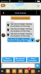
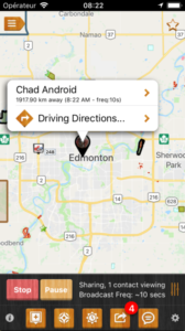
We will be releasing a new version of each region-specific app shortly that will allow you to login to iHunter. Once logged in (with Google, Facebook, or email/password), you can back up all your waypoints, preferences, and settings. This data will be synchronized with other devices (Android or iOS) that you log into with the same account. So if you add waypoints on your iPhone, the will also show up on your Android tablet.

We strongly recommend users make use of the login mechanism. It’s our number one support issue, because a lost or broken device leads to permanently lost data when not logged in. All the data is stored securely, and is encrypted so not even we can view the details of your personal data.

Rollout

Once all province specific app users have had enough time to get the updated app and log into iHunter, we will roll out the new iHunter app. We will notify other iHunter users to migrate to the new app. We are planning to begin the rollout of the login and backup features at the end of August, and probably publish the new container app in early October.

Questions?

Please send any questions or comments to us at info@ihunterapp.com. We will do our best to make this as seamless as possible, and will need your help identifying issues that we don’t catch.

iHunter Pro Tools – Draw and Measure

The iHunter Pro Tools has had the “Draw over Map” feature for a while now. With the latest release, we added the ability to measure distances and areas as well. Have a look at the feature video below to see it in action.

Support dropped for very old versions of iOS and Android

We have tried to maintain backwards compatibility for as long as possible, to help support those who have old devices that are unable to update to newer Android or iOS versions. This support holds us back from advancing the product and adding new features. Despite this, we have tried.

With the addition the Google maps on iOS, the mapping component has a minimum iOS version enforced. To include these features, we needed to drop support for iOS 6. With version 2.0.1 of the iOS app, we did this. iOS 6 users will still be able to download older versions of the app, but no further updates will be available (regulation updates will continue to work for some time). With version 2.0.1, we also accidentally broke support for iOS 7 (oops), but that is being repaired now, and will be fixed in version 2.0.2.

On Android, we were supporting all the way back to Android 2.3 (thats really, really old). To support further development we have dropped 2.3, and our new minimum is Android 3.0.

Ultimately, it becomes more and more difficult to support very old versions, and as things progress, we will need to progress with them. Do let us know if you have any questions or concerns.


Upcoming Features

The “off-season” is when the iHunter team does the vast majority of significant app improvement and development. This year is no exception, and we have been working hard on improving both the iOS and Android apps. Here is a list of upcoming features/fixes that you can expect:

Android and iOS

  1. Ability to bulk-cache landownership maps, and cacheable base maps. If the base map can be cached (labelled as such in the settings), then you can manage that cache. You can select a region of the map, choose a zoom level to cache to, and start downloading. You need to be on wifi, and we limit you to 100 MB of data per download, but the end result is that you can pre-download areas of the map so that when you get into areas with little to no cell reception, you can still have full mapping capabilities.
  2. Addition of a new base maps, from public sources. We are adding a few new Topo maps, and a couple road maps as well.
  3. Allowing custom base maps to be added to the app. Do you have access to a TMS or WMS based map that you want to use instead of the maps we provide? If so, you can enter that map information, and use that instead of our maps (our maps will not be shown, and your map will be base layer). There are all sorts of maps out there on the internet that you can add (assuming you have permission / license to do so).
  4. Allowing custom map layers to be added to the app. Just like the previous point, but you can add map layers on top of the other base maps. Your province or state might have map layers available to show private land boundaries, wildlife habitat densities, or similar information. You still want another base map underneath though, as these layers might only cover part of the map. Like other cacheable maps, these can be bulk-downloaded as long as you confirm that you have a license to do so.
  5. Provide direction to waypoints. When tapping on a waypoint in iHunter, you will be presented with an option to get driving directions to that location from either Google or Apple Maps on your device. We don’t have the manpower to do a full directions based GPS navigation system in iHunter, so we rely on other apps for the actual turn by turn navigation. You can disable this in the settings if you never use the directions.
  6. You can opt to use smaller waypoint icons if you find the standard size icons are too big. As more and more waypoints are added to the map, they can be a bit overwhelming, and this gives those users the option to make them a bit smaller less conspicuous.
  7. Current altitude will be shown in the Location info drawer for quick reference.

Android only

  1. Greatly improved readability of the land ownership and base map layers on higher resolution devices. High resolution devices (pretty much every modern device), were “upscaling” many of the maps and making them pretty difficult to read. This is fixed and will be available shortly.
  2. Updated settings view to more closely replicate the experience on iOS.
  3. Improvements when selecting images within waypoints.
  4. Chronic Wasting Disease drop off locations are now shown on the map, and CWD affected zones are highlighted with a yellow caution sign (Alberta only).

iOS only

  1. Addition of Google road, satellite, terrain and hybrid maps in addition to the Apple and third-party maps. Although it required a re-write of the entire map portion of the app, the maps differ from Apple maps, and many users have been asking for it. As with Apple maps, these are not “cacheable” like our third party maps, as we don’t have access to the raw map data, and rely on Googles own caching mechanism.

We have also hired on another full-time developer that is going to help us keep on top of bug fixes, keep the Android and iOS apps at feature parity, and continue building new features for the different provinces and states. Please let us know if there is something in particular you would like to see, and we will consider it as we prioritize new features.

Thanks,

Mark Stenroos

New Years Purging

A few years back, I decided to satisfy the somewhat frequent requests to provide a Blackberry version of the iHunter. As F&W and many other organizations were still standardized on Blackberry, and it was fairly popular in some provinces, it seemed like a reasonable step.

From a development standpoint, I am happy I did it. I re-worked the entire Android app, vastly improving the code base, in order to re-use large portions for the BB version. I learned some new technologies, grew as a developer, and enjoyed the work. I also made some users happy – for a while at least.

From a business perspective, it was not a great move. BB has been in steady decline, and their market share has reached near-zero for their non-Android phones. The sales have been dismal, and the technology stagnated to a point that I couldn’t really add features (or it didn’t make sense to).

Although the apps will continue to work for a while yet for any existing users, I have removed all Blackberry apps from sale on Blackberry World as of today. My apologies if you are still using a Blackberry device and want the app, but the cost to support and maintain them is too high, and I need to focus on providing improved products for the devices most people use.

Expect big improvements for both iOS and Android this year.

Mark

Interesting Emails

Every so often I receive interesting questions about iHunter via email that surprise me. They surprise me because I think that I have made something clear in the app; perhaps its not clear enough, though.

Question: If iHunter and the official regulations have differences, which one is correct and which one will be enforced?

Answer: The first thing iHunter does when it is installed is tell the user that it is not an official source or legal document. We do our best to maintain accuracy, but mistakes can and do happen. Its up to the user to ensure that they are hunting legally. However, not even the regulation booklet put out by the state or province is a legal document. It is a summary, and mistakes happen there too. Only the Wildlife act (or similar legislation in different jurisdictions) is correct and enforceable. Please double check with other sources and don’t rely solely on iHunter.

Question: I have heard that iHunter has access to my Contact list on my phone. Is this true? I have also heard that iHunter shares my location with Fish and Wildlife so they can find me when I am hunting. Is this true?

Answer: No, neither is true. In our privacy policy, we outline what personal data we look at (virtually nothing). We don’t have access to your contacts and we don’t share your location (or waypoint data) with anyone (unless you choose to send it via email / text).

If you do have questions, please do not hesitate to ask them. I want to clear up mis-conceptions so you can use the app in confidence.